COMMUTING THE OLD FASHIONED WAY - BY FOOT
How to walk the a 1.4 miles from Oilseed to Industrial in thirty-five to forty-five minutes
January 11, 2008
OVERVIEW
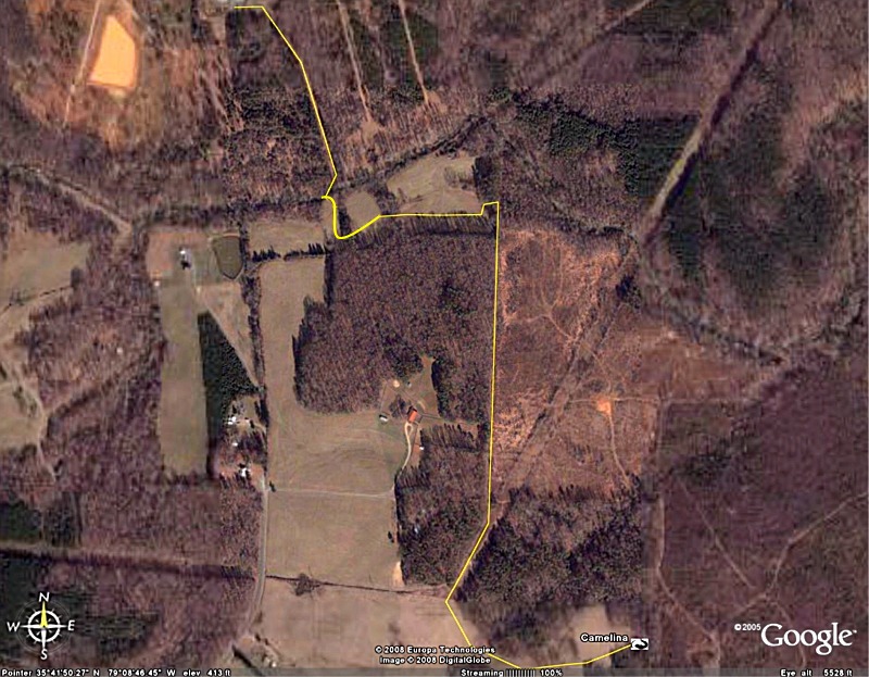
Oilseed Community is at the bottom of the map. It is marked Camelina, which is the name of our house.
To walk from Oilseed to Industrial head west across open space, turning slightly north and crossing through an open barbed wire fence gate by a set of big power lines. Head north northeast along the power lines, then turn left onto a road shortly after the third set of power lines and walk straight north up the pretty Eagle Trail.
Step out into a large clearing and turn sharp left to walk west along the southern edge of the clearing. Keep walking west, following a road into the trees and taking a sharp right north into a smaller clearing. Walk north towards a small set of power lines which follow Robertson Creek. Find the crossing by looking for the pink ribbons, then cut north into the woods to the creek, cross it, head to the right on the other side, and follow another set of power lines north northwest into Industrial.
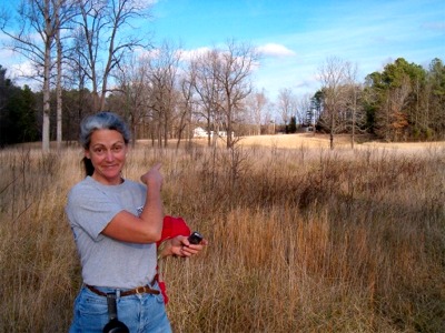
HEAD WEST FROM OILSEED ACROSS OPEN SPACE
Camille points east over her shoulder to Oilseed.
TURN NORTH WEST AT THESE TREES
NOW YOU ARE HEADED NORTH WEST
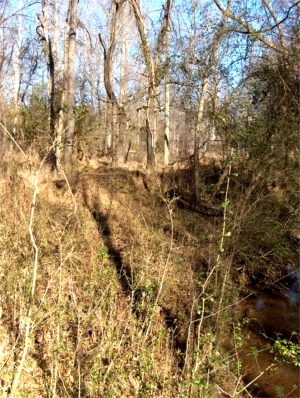
CROSS THIS DITCH AND CONTINUE UPHILL
WALK THROUGH THESE WOODEN GATE POSTS
This wire fence gate is always open.
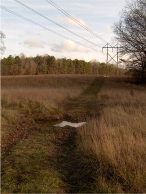
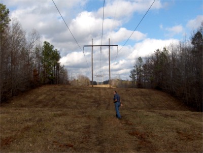
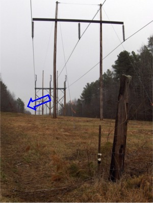
FOLLOW THESE POWER LINES NORTH NORTHEAST TO THE THIRD SET OF POLES
Bob leads the way! These power lines continue north east, reaching Hank's Chapel Road in about five miles.
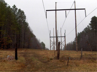
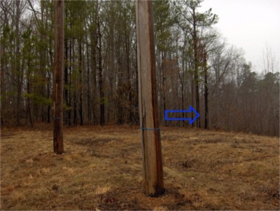
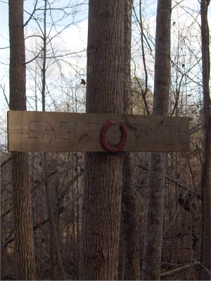
GO TO THE THIRD SET OF POSTS AND TURN NORTH (LEFT) ONTO THE EAGLE TRAIL
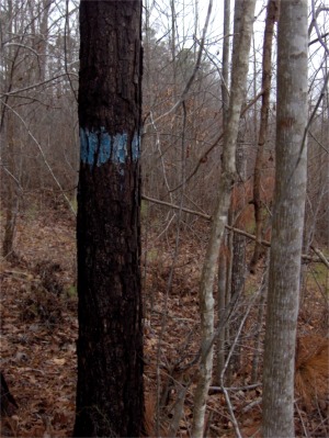
Two views: 1. Looking north to the third set of power lines, where the eagle trail entrance is marked by an arrow on the left side of the power line corridor. 2. Looking west from the east side of the power lines to the wide and well marked (in blue) eagle trail.
DON'T TURN HERE!
These pines mark a small trail to the west of the third set of power poles. Continue on a few feet. The Eagle trail is your next left off the power lines.
TURN (LEFT) NORTH HERE ONTO TO THE EAGLE TRAIL
The is a well-established logging road. You won't be able to miss it. You can also get here by walking straight north off the end of Bill Thomas Road and take a left onto this road.
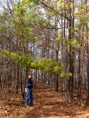
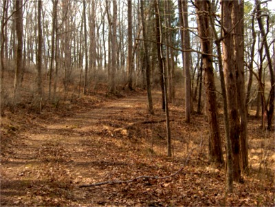
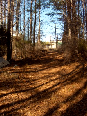
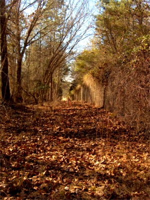
YOU ARE NOW ON THE EAGLE TRAIL
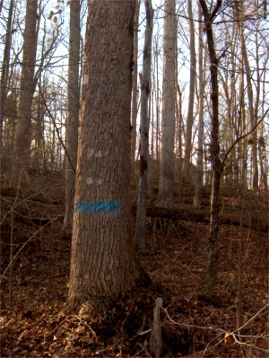
This trail is wide and straight, runs north and south and is well-marked with blue paint and flagging tape. Shortly after you get on this you will notice a house fenced horse paddocks to the west of the trail. This spot can be reached by following Mt. Zion road to the end.
CONTINUE NORTH ALONG THE EAGLE TRAIL
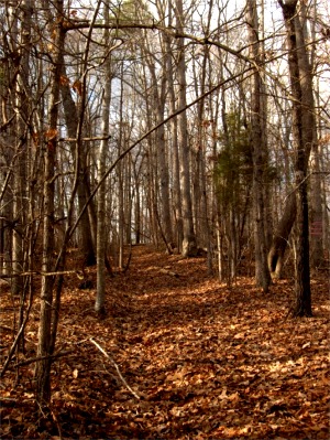
Notice a small bridge on the left, slightly off the trail - this is the halfway mark.
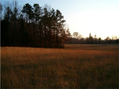
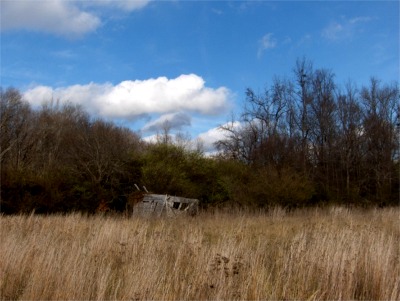
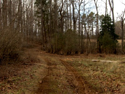
JUST AFTER PASSING A LARGE DOWNED TREE TO THE EAST, THE TRAIL EXITS INTO A CLEARING
You enter the clearing from behind this stand of trees. This photo was taken from the north side of the trees but you will be coming out of the woods on the other side of these trees. Turn left and head up the hill around the edge of the clearing. This photo was taken from below, so the path you want to take is to the right of and beyond these trees. There is an old shed on the bottom of the clearing. You can go this way, too but it isn't as easy, so if you see this broken down shed, turn around and head back uphill.
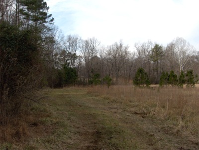
HEAD UPHILL, AND WALK WEST ALONG THE SOUTH EDGE OF THE CLEARING
Looking west, with the trees on your left and the clearing on your right.
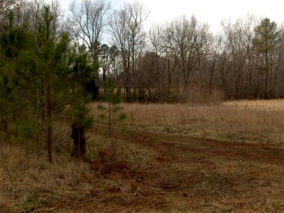
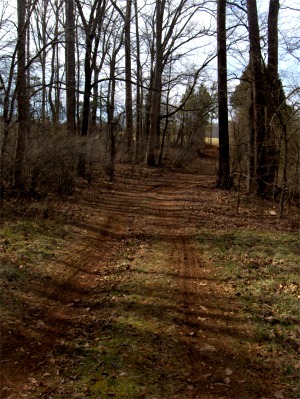
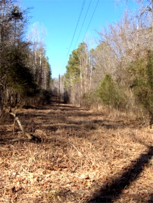
Turn left and follow the road west.
The road cuts through the trees. You can see a second clearing ahead to your right.
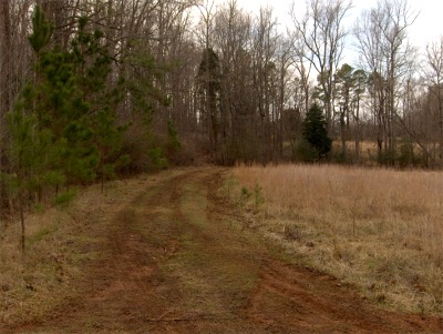
Continue walking along the road through the trees.
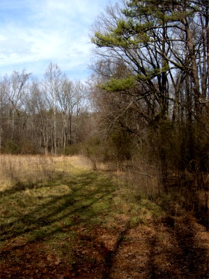
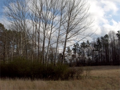
The road is leading you west towards a large pasture or hay field, part of a property off the end of Mt. Zion road but you will turn right (north) before you get there and walk down to the creek.
Here is the intersection where you will turn right into a third little clearing with the hayfield on the left and the road down to the creek forking right.
After turning right (north) you walk downhill along the eastern edge of the clearing towards the power lines.
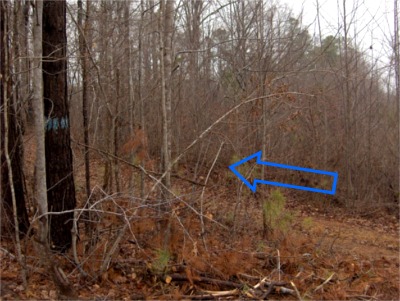
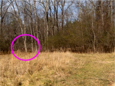
At the bottom of the clearing, look slightly left for a group of pink flagging tape strips.
ENTRANCE TO THE CREEK CROSSING
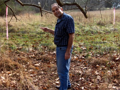
At the pink flagging tape, step into the thick woods and walk about 100 yards to the creek.
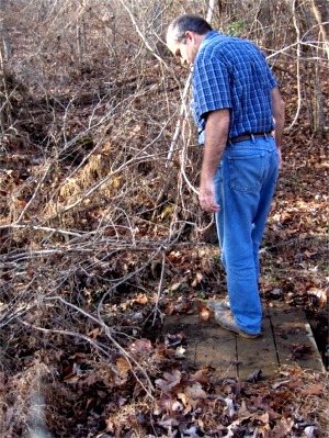
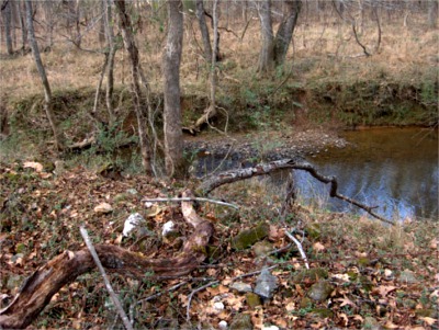
ROBERTSON CREEK
Walk across, stepping on these rocks.
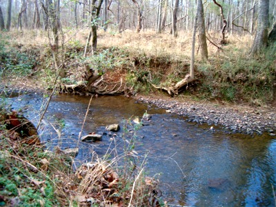
THE OTHER SIDE
Turn right on the other side of the creek. Walk along the creek a short ways to the first set of power lines and turn left.
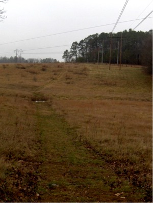
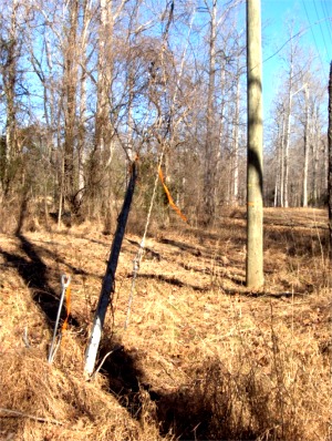
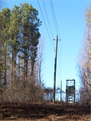
POWER LINES AND DEER STAND
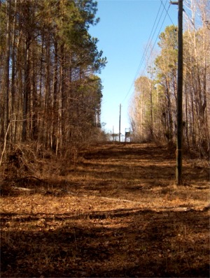
Follow the power lines north northwest. You will pass a deer stand
HOME STRETCH
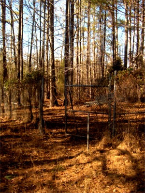
Turn left and walk along this fence to the gate. Walk through the gate and up this corridor which takes you right onto the property at Industrial. That's all there is to it!
[Latest] [ Home ] [ Up ] [ Perfecting the Tempeh Making Process ] [ How to Walk from Oilseed to Industrial ] [ PIEDMONT BIOFUEL'S VERMICULTURE PROJECT ]